Skip to content

Which one to choose in Cape Verde

Sal vs Santo Antão

Two islands in Cape Verde. Sal has 24 tours to book; Santo Antão has 29 tours to book. The table and the two notes below put them side by side; the full pages have how to get there, what to see and when to go for each.

Sal

Sal

Cape Verde

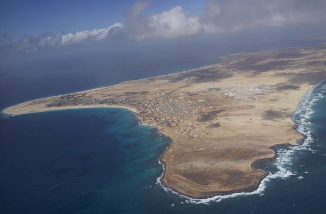
Sal is a flat, dry island of 215 square kilometres in the Cape Verde archipelago, about 560 km off the coast of West Africa. It has the country's busiest international airport, long white beaches around the resort town of Santa Maria and steady trade winds that make it one of the best places in the Atlantic to kitesurf.

Read the full guide →

Santo Antão

Santo Antão

Cape Verde

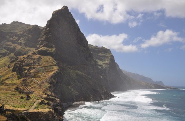
Santo Antão is the mountain island of Cape Verde, the westernmost of the chain and its second largest, with peaks near 2,000 metres, terraced green valleys and cliff paths. It has no working airport, so walkers arrive by an hour-long ferry from Mindelo on Sao Vicente, and it is the best hiking in the archipelago.
Read the full guide →

Side by side

SalSanto Antão
Gateway & travel time15 to 20 min by road to Santa Maria from Sal airport (Amílcar Cabral International)About 1 h by ferry from Mindelo, Sao Vicente
DaysA week or more3 to 5 nights
Best monthsNov–Jun dry, sunny and windy; Jul–Oct hotter and calmer, turtles nestNov–Jun dry and best for hiking; Aug–Oct rainy, green, some paths slippery
CarAluguer minibuses link Santa Maria and Espargos; taxis, quads or a hire car for the restShared minibuses (aluguers) and taxis; hire a driver for a day, then walk
CostMid-range; pricier than the rest of Cape VerdeCheap, even by Cape Verde standards
BeachesWhite sand and clear water at Santa Maria and Ponta Preta; Kite Beach in the east for windAlmost none; rough black pebble shores, a small black-sand beach at Tarrafal de Monte Trigo
Area215 km²779 km²
Population35,267 (2018)38,200 (2019)
Highest point406 m (Monte Grande)1,979 m (Topo da Coroa)
Tours online2429

Where they are

Tours and activities in Cape Verde