Maria Island
Australia
Maria Island is a mountainous national park 4 km off the east coast of Tasmania, reached by a 30-minute ferry from…
211 tours & trips
Australia · Indian Ocean · Nature & wildlife island
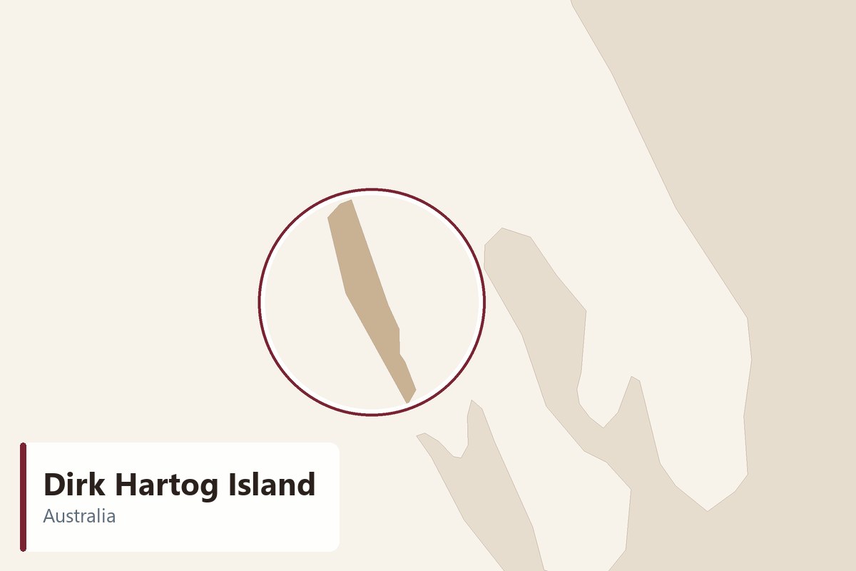
Dirk Hartog Island is Western Australia's largest and westernmost island, about 80 km long, guarding the outer edge of the Shark Bay World Heritage Area some 850 km north of Perth. Almost all of it is a national park, with ocean cliffs, empty bays and a project returning the island's native animals.
| Getting there | Vehicle barge from Steep Point (4WD only), boat from Denham, or charter flight to the island airstrip |
|---|---|
| Gateway | Denham or Steep Point (Shark Bay) |
| Travel time | Short barge from Steep Point; longer boat from Denham |
| Days | 3 to 5 nights |
| Best months | Apr–Oct cooler and drier; Jul–Oct whales; Dec–Feb very hot and windy |
| Getting around | 4WD only on sand and rock tracks; no shops or fuel, so carry everything |
| Booking | Camping permits, the barge and the lodge months ahead, especially in school holidays |
| Cost | Expensive, even by Western Australian standards |
| Beaches | White bays on the Shark Bay side; Turtle Bay in the north; wild surf below the western cliffs |
| Sea | Indian Ocean |
| Area | 620 km² |
| Population | 9 (2021) |
| Highest point | 81 m |
| Airport | No |
| Car-free | No |
| UNESCO | Shark Bay, Western Australia |
| Checked | October 2026 |
Very little is sold for Dirk Hartog Island, which reflects how hard it is to reach. Two guided options are listed. One is a full-day 4WD safari from Denham that drives the long sand road to Steep Point, the westernmost tip of the Australian mainland, and crosses to the island; the other is a day exploring the island in a 4WD with a local guide, starting on the island. Both normally include the vehicle, the driver-guide, park access and lunch, but check whether barge or boat crossings are included, and expect very long days.
Most visitors who stay longer either book the eco lodge on the island, which arranges transfers, meals and guided drives, or come self-sufficient with their own 4WD, camping permits and a booked barge crossing. Boat charters from Denham also run fishing and sightseeing trips to the island's east coast, and scenic flights over Shark Bay pass over it.
For a first visit without your own equipped 4WD, the guided day from Denham is the sensible choice. If you have a capable vehicle and recovery gear, several nights camping on the island are the real reward.
At the northern tip is the place where Dirk Hartog landed in 1616 and nailed an inscribed pewter plate to a post, the oldest known record of a European landing in Australia. Replica plates, a lighthouse and the old keepers' cottages stand on the windswept headland. It is a long, slow drive from the south of the island.
The ocean side of the island is a line of high limestone cliffs facing the full force of the Indian Ocean. Tracks lead to lookouts where swell explodes against the rock and blowholes spout. Humpback whales pass offshore in the cooler months. Keep well back from the edge, as the cliffs are undercut and the wind is strong.
This sheltered bay near Cape Inscription is the main nesting beach for loggerhead turtles in summer, when females come ashore at night and hatchlings head for the sea weeks later. Watch from a distance, never use lights near nests, and stay off the dunes. At other times it is a quiet white beach for a swim.
The eastern coast faces the calm waters of Shark Bay, with white sand bays, seagrass meadows and shallow water ideal for snorkelling and fishing from the beach. Dolphins, rays and turtles are often seen close in, and dugongs graze the seagrass offshore. Most campsites are spread along this side.
Before you cross, stand on the westernmost point of mainland Australia, a dramatic headland of cliffs above the South Passage. It is a famous spot for land-based game fishing. The last stretch of road is soft sand and needs a 4WD with lowered tyres; the barge to the island leaves from a nearby bay.
Our pick for each kind of trip, with live dates and prices. Free cancellation on most.
Best for: First visit, a full day from Denham
A guided 4WD day from Denham to Steep Point and across to the island, the simplest way to see this remote corner without your own vehicle or permits.
The island lies across South Passage from Steep Point, at the end of a long road that turns off the highway near the Overlander Roadhouse and becomes deep sand for the final stretch, passable only by high-clearance 4WD with reduced tyre pressure. A small vehicle barge crosses the passage in minutes; it must be booked in advance and runs to a schedule. Denham, the Shark Bay town, is about nine to ten hours' drive from Perth and has an airport with regional flights in some years, so check current services.
From Denham, boat charters cross the bay to the island's east coast, and lodge guests can arrange transfers by boat or light aircraft to the island airstrip. There is no public ferry. Bring fuel, water and food for your whole stay.
A high-clearance 4WD is essential, with recovery gear, a compressor and spare tyres, because the tracks are soft sand, limestone and corrugations. Distances are long and slow: the drive to Cape Inscription takes most of a day each way. There are no shops, fuel or reliable phone coverage, and vehicle numbers are limited by permit. Lodge guests are driven on guided excursions; there are no taxis, buses or rentals on the island.
The best months are April to October, when days are warm and dry and nights cool, with July to October bringing humpback whales along the coast and wildflowers on the mainland. Winter can be windy, and a cold front sometimes brings rain and rough seas that stop boat transfers.
From December to February it is very hot, often above 40 degrees inland, with relentless southerly winds and flies; loggerhead turtles nest in these months, though, so summer suits keen wildlife watchers. Western Australian school holidays, especially in April and the July and September breaks, are the busiest time for campers, and permits and barge places sell out. Fishing is good all year. A day trip gives a taste, but three to five nights are needed to reach the far north and enjoy the remoteness.
There are only two options on the island. The eco lodge, built around the old station homestead on the east coast, offers full board, guided drives and transfers, and suits those without their own 4WD. Otherwise, campers use designated beach sites with permits, with no facilities beyond basic toilets at a few sites; you must be fully self-sufficient. Many visitors base themselves in Denham or Monkey Mia instead and come for a day.
The Malgana people know the island as Wirruwana and have lived around Shark Bay for many thousands of years. Dirk Hartog's ship Eendracht reached this coast in 1616, and in 1697 Willem de Vlamingh replaced Hartog's plate with his own; both originals are now in museums. For over a century the island was a sheep station, which left eroded country and feral goats and cats. Since becoming a national park, it has been the scene of the Return to 1616 project, which removed introduced animals and is bringing back native marsupials and birds.
Dirk Hartog belongs on a Shark Bay trip: the dolphins at Monkey Mia, the stromatolites at Hamelin Pool, Shell Beach and the red cliffs of François Peron National Park are all within a few hours of Denham. Further north, Coral Bay and Ningaloo Reef are about five to six hours' drive.
Vehicle barge from Steep Point (4WD only), boat from Denham, or charter flight to the island airstrip.
From Denham or Steep Point (Shark Bay): short barge from Steep Point; longer boat from Denham.
3 to 5 nights.
Apr–Oct cooler and drier; Jul–Oct whales; Dec–Feb very hot and windy.
4WD only on sand and rock tracks; no shops or fuel, so carry everything.
Go if you want a remote 4WD island with ocean cliffs, fishing, turtles and almost nobody else around. Skip it or choose a day at Monkey Mia and Denham if you do not have a capable 4WD, time to plan or the budget for a guided trip.
Expensive, even by Western Australian standards.
White bays on the Shark Bay side; Turtle Bay in the north; wild surf below the western cliffs.
Camping permits, the barge and the lodge months ahead, especially in school holidays.
Yes. Boat trips, guided tours and day trips for Dirk Hartog Island can be booked online; live prices and free cancellation on most are shown on this page.
Australia
Maria Island is a mountainous national park 4 km off the east coast of Tasmania, reached by a 30-minute ferry from…
211 tours & trips
Australia
Phillip Island is a low, farm-covered island about 125 km south-east of Melbourne, joined to the mainland by a bridge…
45 tours & trips
Australia
Rottnest Island is a low, sandy, car-free reserve 18 km off Fremantle, with turquoise bays, salt lakes and the small…
33 tours & trips
Australia
Tasmania is Australia's island state, about 240 km south of the mainland across Bass Strait, with a main island of…
33 tours & trips
Australia
Moreton Island is a sand island of high dunes and long beaches on the eastern edge of Moreton Bay, about 58 km…
24 tours & trips
Australia
Magnetic Island lies 8 km off Townsville in tropical north Queensland, a granite island of about 52 square kilometres,…
23 tours & trips