Skip to content

Which one to choose in Yaeyama Islands

Ishigaki vs Taketomi

Two islands in Yaeyama Islands. Ishigaki has 55 tours to book; Taketomi has 9 tours to book. The table and the two notes below put them side by side; the full pages have how to get there, what to see and when to go for each.

Ishigaki

Ishigaki

Yaeyama Islands, Japan

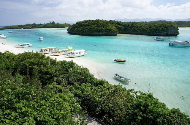
Ishigaki is a subtropical island in the far south of Japan, about 400 km south-west of Okinawa's main island and closer to Taiwan than to Tokyo. It is the hub of the Yaeyama Islands, with coral reefs, mangrove rivers, a turquoise bay at Kabira and Mount Omoto, at 525 metres the highest peak in Okinawa Prefecture.

Read the full guide →

Taketomi

Taketomi

Yaeyama Islands, Japan

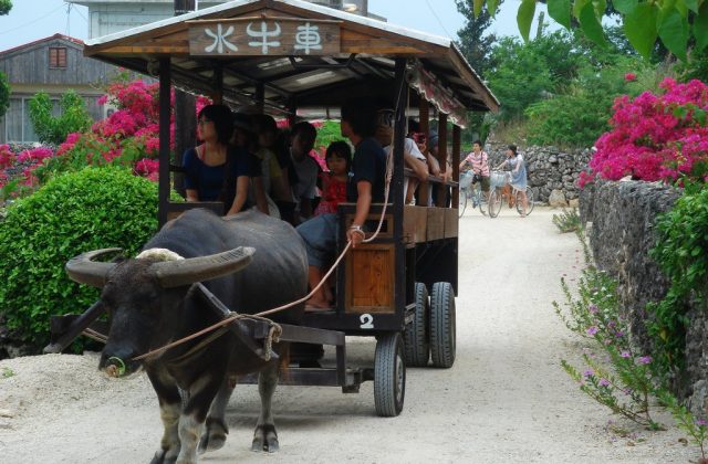
Taketomi is a tiny, flat coral island 4 km south of Ishigaki in Okinawa's Yaeyama group, with a single village of red-tiled houses, coral-stone walls and white sand lanes that looks much as Ryukyu villages did a century ago. Only about 5 square kilometres in size, it is an easy half-day by ferry and bicycle.
Read the full guide →

Side by side

IshigakiTaketomi
Gateway & travel timeAbout 1 h by air from Naha; 3.5 h from Tokyo from Ishigaki airport; flights from Tokyo or Naha10 to 15 min by ferry from Ishigaki (Remote Island Terminal)
Days3 to 5 nightsA day trip is enough
Best monthsApr–Jun and Oct–Nov; rainy May–Jun; typhoon risk Aug–SepApr–Jun and Oct–Nov; Jul–Sep hot with typhoon risk; rainy season May–June
CarRent a car; buses circle the island; ferries to the outer islands from the portRent a bicycle at the port; a buffalo cart through the village; no car needed
CostMid-range by Japanese standardsMid-range for Okinawa; day trips are cheap
BeachesWhite coral sand: Yonehara for snorkelling, Sukuji for families; no swimming in Kabira BayShallow white-sand lagoon at Kondoi for swimming; Kaiji beach for star sand, no swimming
Area222 km²5.4 km²
Population47,666 (2007)323 (2012)
Highest point525 m (Mount Omoto)21 m
Tours online559

Where they are

Tours and activities in Yaeyama Islands