Mallorca
Balearic Islands, Spain
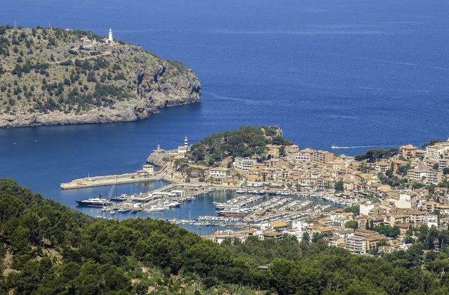
Mallorca is the largest of the Balearic Islands, about 3,640 square kilometres of coast and mountains off eastern…
909 tours & trips
Spain · Atlantic Ocean · Nature & wildlife island
The Cíes Islands are three small, car-free islands at the mouth of the Ría de Vigo in Galicia, part of the Atlantic Islands national park. White sand beaches face the mainland, sheer cliffs and seabird colonies face the ocean, and a daily visitor cap keeps them calm even in August.
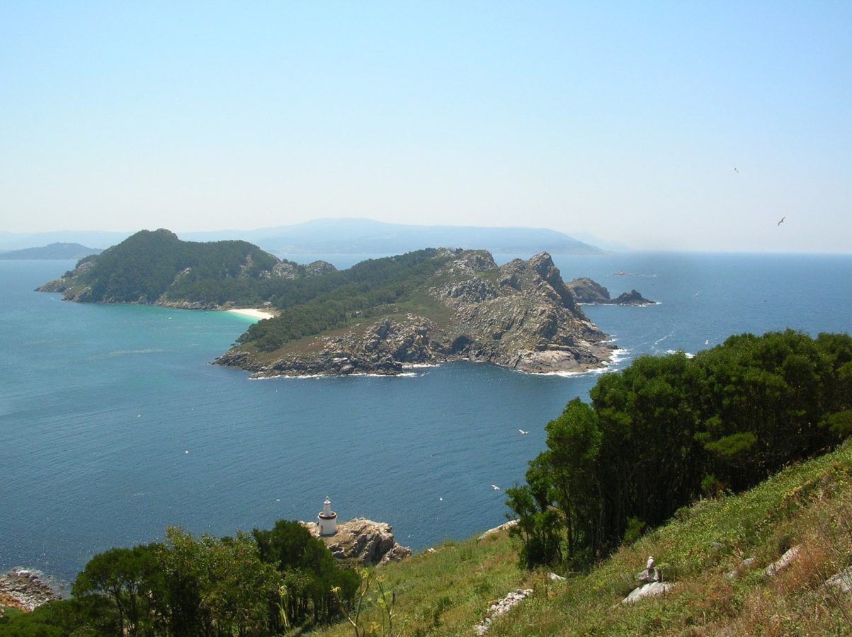
Photo: No machine-readable author provided. Caos~commonswiki assume, CC BY-SA 3.0
| Getting there | Passenger ferry from Vigo, Cangas or Baiona in about 45 min; mid-May to September and Easter only |
|---|---|
| Gateway | Vigo (ferry port) |
| Travel time | About 45 min by ferry |
| Days | A day trip is enough |
| Best months | June–September; permit and ferry needed in season, few or no boats Oct–Apr |
| Getting around | Car-free: walk on marked paths from the pier; no transport on the islands |
| Booking | Free visitor permit, then ferry ticket, days or weeks ahead in July–August |
| Cost | Cheap; the ferry is the main expense |
| Beaches | White sand and cold, clear water; Rodas is the long sandbar, Figueiras and Nosa Señora are quieter |
| Sea | Atlantic Ocean |
| Area | 4.5 km² |
| Population | 4 (2022) |
| Highest point | 197 m (Alto das Cies) |
| Ferry | 45 min from Vigo (ferry port) |
| Airport | No |
| Car-free | Yes |
| Checked | November 2026 |
Because the Cíes are a national park with a daily cap on visitors, almost everything sold is a way of getting there rather than a guided tour.
The main product is the return ferry: from Vigo and Cangas, from Moaña, and in summer from Baiona and Portonovo on the north shore of the ría, landing near Rodas beach. In the main season you also need the free daily permit from the Galician government before a ticket can be issued; some sellers request it for you. Once ashore you are on your own, with no guide or lunch, and you return on the boat shown on your ticket.
From Santiago de Compostela, day trips add the coach to Vigo and the ferry, useful without a car, though they leave less time on the island than going yourself.
To see the islands from the sea, sailing boats with a skipper leave Vigo for a half or full day, crossing the ría and anchoring off the beaches for a swim; a boat trip from Baiona does a similar loop through its bay. Private charters suit groups. Check whether the trip lands you on the island, as many stay on the water.
Take the first ferry of the morning, carry food and water, and come back on a late boat. Add a sailing trip on another day if you want to see the cliffs from below.
A curve of white sand about 1.2 km long joins the northern island of Monteagudo to the middle island, do Faro, with the calm ría on one side and a shallow lagoon on the other. It is a few minutes from the pier. The water is clear and cold, so swim early in your visit and walk in the afternoon.
The main path runs south from the pier over the sandbar and up the island of do Faro to the lighthouse on its summit. Allow about three hours there and back with stops. From the top you see the cliffs of the Atlantic side, the islet of San Martiño to the south and, on clear days, the whole ría.
A shorter path from the campsite area climbs to a headland on Monteagudo, where a natural stone seat looks down on the cliffs and on Figueiras beach. It takes about an hour each way at an easy pace and is the best spot on the islands for late-afternoon light.
The western cliffs hold one of the largest colonies of yellow-legged gulls in Europe, along with shags and other seabirds. Wooden hides along the paths let you watch without disturbing the nests. In spring the gulls are loud and protective, so stay on the marked paths.
A path north from Rodas leads along the eastern shore of Monteagudo, past the small beaches of Figueiras and Muxieiro, to a lighthouse facing the open ocean. It is a quieter walk than the southern route, about an hour each way, with pine woods and views back across the ría to Cangas.
Our pick for each kind of trip, with live dates and prices. Free cancellation on most.
Best for: First visit, a day from Vigo
The return ferry from Vigo or Cangas with time on the islands to walk to the lighthouse and swim at Rodas, the simplest way to go.
Only passenger ferries go to the islands, and only in season: daily from about mid-May to the end of September and at Easter, with some weekend sailings in spring. From Vigo the crossing takes about 45 minutes; boats also leave Cangas, Moaña and Baiona, and from the resorts of Sanxenxo and Portonovo on the next ría.
From June to September, and on some busy dates outside it, you must first get a free permit online from the Galician government for your chosen date, then buy the ferry ticket. Permits for August weekends go quickly, so book a week or more ahead. Ferries land at the pier on Monteagudo near Rodas beach. Vigo has an airport and trains from Santiago and Madrid; park in the city and walk to the ferry terminal.
There are no cars, bicycles or roads to speak of, only sandy tracks and marked footpaths starting at the pier. Everything is reached on foot: the lighthouse walk is the longest, and the beaches near the pier are a few minutes away. Wear proper shoes, take a hat and plenty of water, as shade is limited and there are only a few drinking fountains. San Martiño, the southern island, has no ferry service. Carry your rubbish back with you.
The season is short. July and August have the most reliable weather and the full ferry timetable, but also the permit limit, so the islands are busy, never packed. June and September are the best balance: long days, warm air and easier permits.
The Atlantic is cold here, often below 20 degrees even in August, so swimming is brisk. Sea fog can sit over the ría on summer mornings and usually lifts by midday, while wind from the north can make the open-sea side chilly. Between October and Easter there are few or no ferries and the campsite is closed, and visiting means hiring a private boat with park permission.
Most people come for one day. If you want an evening on the islands and the sunrise, stay a night at the campsite.
The only place to sleep on the islands is the campsite near Rodas beach, open in summer with fixed tents for hire, a shop and a restaurant; it must be booked together with the ferry. Otherwise base yourself on the mainland. Vigo has the most choice and the main ferry terminal. Baiona is a pretty harbour town with beaches and its own ferry, and Cangas across the ría is smaller and cheaper.
Remains of Iron Age hill forts show that people lived on the islands long before the Romans, and a monastery stood on the middle island in the Middle Ages. Exposed at the mouth of a rich bay, the islands suffered pirate and English raids, and the monks left. In the nineteenth and twentieth centuries a few families farmed, fished and salted sardines here, and the ruins of their houses remain. The islands became a nature reserve in 1980 and part of a national park in 2002.
Vigo makes a natural base for two or three days, with the islands on one of them. The other islands of the same national park, Ons and Sálvora, lie to the north off the Rías Baixas; Ons has its own summer ferries from Sanxenxo and Portonovo. Santiago de Compostela is about an hour and a half by road or train, and the Portuguese border is under an hour south.
Passenger ferry from Vigo, Cangas or Baiona in about 45 min; mid-May to September and Easter only.
From Vigo (ferry port): about 45 min by ferry.
A day trip is enough.
June–September; permit and ferry needed in season, few or no boats Oct–Apr.
No. Cíes Islands is car-free. Car-free: walk on marked paths from the pier; no transport on the islands.
Go if you want a day of white-sand beaches, cliff-top walks and seabirds just 45 minutes from Vigo. Skip it or choose a mainland beach near Baiona if you want warm water, shade, restaurants or a hotel. With about 45 min each way from Vigo (ferry port), a day trip is easy to do.
Cheap; the ferry is the main expense.
White sand and cold, clear water; Rodas is the long sandbar, Figueiras and Nosa Señora are quieter.
Free visitor permit, then ferry ticket, days or weeks ahead in July–August.
Yes. Boat trips, guided tours and day trips for Cíes Islands can be booked online; live prices and free cancellation on most are shown on this page.
Balearic Islands, Spain
Mallorca is the largest of the Balearic Islands, about 3,640 square kilometres of coast and mountains off eastern…
909 tours & trips
Canary Islands, Spain
Tenerife is the largest of the Canary Islands, 2,034 square kilometres of Atlantic volcano off north-west Africa,…
723 tours & trips
Balearic Islands, Spain
Ibiza is the third-largest of the Balearic Islands, 577 square kilometres of pine hills, small coves and salt pans…
372 tours & trips
Canary Islands, Spain
Gran Canaria is a round volcanic island of 1,560 square kilometres in the Canaries, rising from the dunes of Maspalomas…
350 tours & trips
Canary Islands, Spain
Lanzarote is the easternmost of the Canary Islands, about 125 km off the coast of Africa, a low island of black lava…
273 tours & trips
Canary Islands, Spain
Fuerteventura is the second-largest of the Canary Islands and the closest to Africa, about 97 km off the Moroccan…
233 tours & trips