Tenerife
Canary Islands, Spain
Tenerife is the largest of the Canary Islands, 2,034 square kilometres of Atlantic volcano off north-west Africa,…
723 tours & trips
Spain · Atlantic Ocean · Nature & wildlife island
El Hierro is the smallest and most westerly of the main Canary Islands, about 269 square kilometres of volcanic cliffs, pine forest and lava fields with fewer than 12,000 people. It draws divers to the marine reserve at La Restinga and walkers to a landscape far from mass tourism, with almost no sandy beaches.
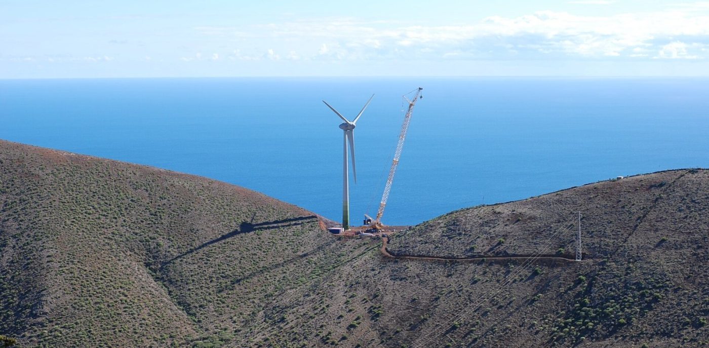
Photo: Erik Streb, CC BY-SA 3.0
| Getting there | Ferry from Los Cristianos on Tenerife in about 2.5 to 3 h, or short flights from Tenerife North and Gran Canaria |
|---|---|
| Gateway | Tenerife (Los Cristianos) or El Hierro airport |
| Travel time | 2.5 to 3 h by ferry or about 40 min by air |
| Days | 3 to 5 nights |
| Best months | Year-round; Apr–Oct best for diving and hiking, Sep–Oct warmest sea |
| Getting around | Rent a car; buses are few, and roads twist through tunnels and over mountain passes |
| Booking | Car hire and flights ahead; dives at La Restinga a few days ahead in summer |
| Cost | Mid-range, cheaper than Tenerife's resorts |
| Beaches | Few beaches: swim in lava rock pools at Charco Azul and La Maceta; red sand at Playa del Verodal |
| Sea | Atlantic Ocean |
| Archipelago | Canary Islands |
| Area | 269 km² |
| Population | 11,806 (2024) |
| Highest point | 1,501 m (Pico de Malpaso) |
| Airport | Yes, scheduled flights |
| Car-free | No |
| Checked | October 2026 |
Almost nothing is sold online for El Hierro except a private airport transfer, and that says a lot about the island: there are no big tour operators, no catamaran cruises and no coach excursions. A transfer is useful if you do not plan to drive on the first day, but most visitors pick up a hire car at the airport or the port.
What you arrange locally is excellent. The dive centres of La Restinga, in the south, run boat dives in the Mar de las Calmas marine reserve, with try dives for beginners and trips to the volcanic reefs formed after the 2011 eruption; book a few days ahead in summer. Hiking needs no guide on the marked trails, but small local outfits offer guided walks and jeep tours of the high plateau and the juniper forest for those who prefer not to drive. Paragliding flights over El Golfo, kayaking along the coast and visits to the giant lizard breeding centre are also booked on the island.
The plain recommendation is to hire a car for your whole stay, plan two days of walking and one of diving or snorkelling, and leave a free day for the coastal pools.
The north-west of the island is a vast curved cliff, the rim left when a huge piece of El Hierro slid into the sea long ago. Look down on it from the Mirador de la Peña, a viewpoint and restaurant designed by César Manrique, then drive down to the farms and villages of Frontera and Tigaday on the valley floor.
The fishing harbour at the southern tip is the island's diving base. The Mar de las Calmas, sheltered from the trade winds, has clear warm water, groupers, rays and dramatic lava arches, with sites for every level. Snorkellers can swim from the harbour beach. It is about an hour by road from Frontera.
On the windswept western plateau, junipers bent almost horizontal by the wind have become the island's symbol. Continue to the Ermita de los Reyes and the Orchilla lighthouse, close to the old zero meridian that mapmakers used before Greenwich. The roads are narrow and lonely, so fill up with fuel first.
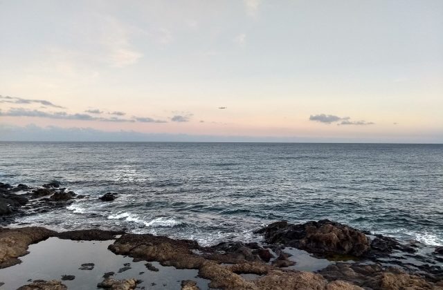
With so little sand, islanders swim in natural pools among the lava. Charco Azul, in El Golfo, is a turquoise lagoon under a rock arch, and La Maceta nearby has concrete pools fed by the sea. Tamaduste and La Caleta, near Valverde, are calmer coves. Avoid them when the swell is big, as waves break over the rocks.
The original inhabitants collected water from mist dripping off a sacred tree, the Garoé; a replacement tree and old cisterns mark the spot on the ridge above Valverde. From here walk through the pine forests of Hoya del Morcillo or along the old pilgrim trail, the Camino de la Virgen, which crosses the island.
The small capital sits inland on a hillside, the only Canary capital away from the coast, chosen for safety from pirates. Its white church, steep streets and local bars make a gentle half-day, and the airport and port are both close. The ethnographic museum and nearby viewpoints explain island life before tourism.
Live dates and prices. Free cancellation on most tours.
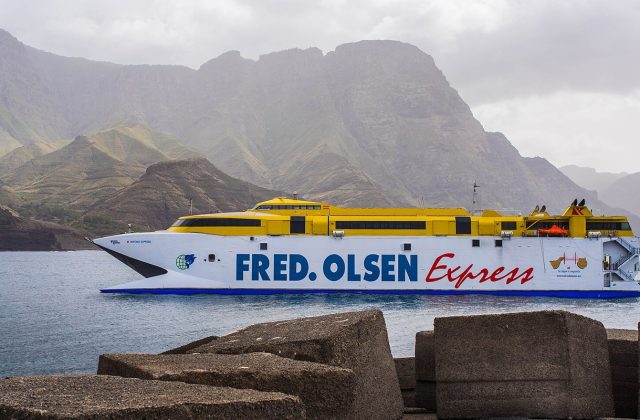
Ferries leave from Los Cristianos in the south of Tenerife for La Estaca, El Hierro's port near Valverde; crossings run most days and take about two and a half to three hours. The open Atlantic can be rough, so take seasickness tablets if you are prone. Both Naviera Armas and Fred. Olsen have served the route, and you can take a hire car or your own vehicle on board.
The small airport near Valverde has inter-island flights from Tenerife North and Gran Canaria several times a day, taking about 40 minutes from Tenerife; connections from mainland Spain and the rest of Europe go through those islands. Flying is quicker and usually more reliable in winter. There are no direct international flights and no cruise port of note.
A car is close to essential. Hire firms meet flights and ferries, and the island is small, but roads climb steeply, twist through hairpins and cross a high central plateau that can be shrouded in cloud. A road tunnel links Valverde with El Golfo and saves a long drive over the mountain. Local buses connect the villages but run only a few times a day. Taxis are available in Valverde and Frontera, and hikers can walk many routes point to point.
El Hierro has a mild climate all year, but each side differs. The north-east catches the trade-wind clouds and drizzle, while the south and El Golfo are sunnier and warmer. Air temperatures on the coast stay roughly between 18 and 28 degrees through the year, cooler on the plateau.
April to October is best for diving and hiking, with calmer seas, long days and the warmest water, about 22 to 24 degrees by September and October. Winter brings more rain, Atlantic swells that close the pools and occasional cancelled ferries, but walking is still good and prices are low. Spanish holidays in August are the busiest time. Every four years, in early July, the island celebrates the Bajada de la Virgen, a pilgrimage carrying the image of the Virgin across the island from its western shrine to Valverde. Three to five nights is the right length.
El Golfo, with Frontera, Tigaday and Las Puntas, is the most popular base: sunny, green, close to the pools and the west of the island, with rural houses and small hotels. La Restinga in the south suits divers, with simple apartments next to the harbour and warm water. Valverde and the coastal hamlets of Tamaduste and La Caleta are handy for the airport and ferry but cloudier. There are no large resorts anywhere.
The Bimbache people, related to the other Guanche peoples of the islands, lived here until the Castilian conquest in the early fifteenth century, and left rock carvings at El Julan. For centuries Europe placed its zero meridian at the island's western tip, the edge of the known world. The island stayed poor and isolated, and many islanders emigrated to Cuba and Venezuela. In 2011 a submarine eruption off La Restinga discoloured the sea for months, and today a wind and pumped-water power station supplies much of its electricity, a model for clean energy on small islands.
El Hierro fits a trip through the western Canaries. Tenerife is a few hours by ferry or a short flight, and from Los Cristianos boats reach La Gomera in under an hour. La Palma is easily reached by inter-island flights through Tenerife, making a quiet circuit of the three western islands.
Ferry from Los Cristianos on Tenerife in about 2.5 to 3 h, or short flights from Tenerife North and Gran Canaria.
From Tenerife (Los Cristianos) or El Hierro airport: 2.5 to 3 h by ferry or about 40 min by air.
3 to 5 nights.
Year-round; Apr–Oct best for diving and hiking, Sep–Oct warmest sea.
Rent a car; buses are few, and roads twist through tunnels and over mountain passes.
Go if you want quiet hiking, superb diving and dramatic volcanic scenery without resorts or crowds. Skip it or choose Tenerife or Fuerteventura if you want sandy beaches, nightlife, guaranteed sunshine or easy connections from mainland Europe.
Mid-range, cheaper than Tenerife's resorts.
Few beaches: swim in lava rock pools at Charco Azul and La Maceta; red sand at Playa del Verodal.
Car hire and flights ahead; dives at La Restinga a few days ahead in summer.
Yes. Boat trips, guided tours and day trips for El Hierro can be booked online; live prices and free cancellation on most are shown on this page.
Canary Islands, Spain
Tenerife is the largest of the Canary Islands, 2,034 square kilometres of Atlantic volcano off north-west Africa,…
723 tours & trips
Canary Islands, Spain
Gran Canaria is a round volcanic island of 1,560 square kilometres in the Canaries, rising from the dunes of Maspalomas…
350 tours & trips
Canary Islands, Spain
Lanzarote is the easternmost of the Canary Islands, about 125 km off the coast of Africa, a low island of black lava…
273 tours & trips
Canary Islands, Spain
Fuerteventura is the second-largest of the Canary Islands and the closest to Africa, about 97 km off the Moroccan…
233 tours & trips
Canary Islands, Spain
La Palma is the most north-westerly of the Canary Islands, a steep green volcanic island of about 708 square kilometres…
76 tours & trips
Canary Islands, Spain
Isla de Lobos is an uninhabited volcanic islet of under 5 square kilometres, 2 km off the northern tip of Fuerteventura…
28 tours & trips